
A team of explorers led by Tony Romeo, former Air Force intelligence officer, is convinced that they have solved one of the greatest mysteries in the history of aviation: the disappearance of Amelia Earhart, legendary pioneer of the air, who sank with the navigator Fred Noonan in July 1937 aboard his twin-engine plane as he attempted to complete a trip around the world, the first woman to do so.
Romeo and his team at Deep Sea Vision (DSV) believe they have located the wreckage of the plane, almost intact, on a sandy bottom of the Pacific Ocean at almost 5,000 meters deep. Further dives and research, already planned, will be needed to confirm the hypothesis.
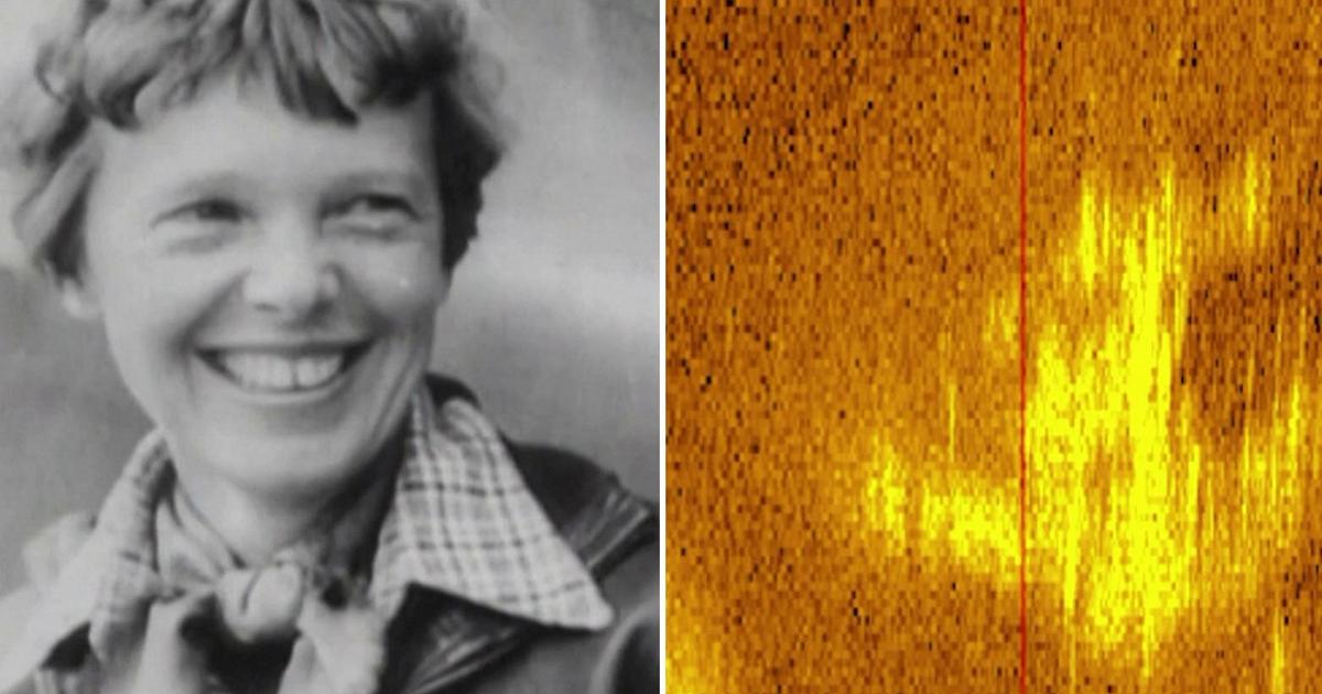
Meanwhile, Romeo explained how they came to the conclusion that the sonar image released by the company – little more than a colored spot on a blurry background – does indeed show the silhouette of Earhart’s Lockheed 10-E Electra.
The DSV crew of “underwater archaeologists and marine robotics experts” set out on Amelia’s trail in a three-month mission along the route of that last, fatal flight that left Papua New Guinea and headed to Howland Island , in the central Pacific Ocean.
The examination of the trajectory traveled by the aircraft, the last radio communications before the disappearance – Earhart had reported that she was running out of fuel -, the analysis of the winds and a “mathematical and probabilistic approach” to what Romeo defines as “the enigma perfect” allowed us to identify the possible place where the plane sank.
DSV did not disclose the exact location, but said it was about 160 kilometers west of Howland Island, where the pilot hoped to refuel, halfway between Australia and Hawaii.
The company’s press release said the team relied partly on a theory that the navigator, Fred Noonan, may have forgotten to turn back the calendar when they crossed the International Date Line, resulting in navigation errors.
Using a state-of-the-art submersible, Romeo and his team explored an area of approximately 13,500 square kilometers of seabed, using sonar to map 1,600 meters at a time. The fruit of this painstaking work is that sonar image in which an object can be seen in relief at a depth of almost 5,000 metres, similar in shape and size to Amelia Earhart’s plane.
“In the image you can see the two vertical stabilizers at the rear very clearly,” Romeo told Reuters. He plans to return to the site soon to obtain better images with a remotely operated vehicle (ROV) and eventually recover the wreckage in the hope to “finally bring Amelia home”.